Geophysical Imaging and Monitoring
New book chapter on multimethod geophysical imaging
Posted on 2021/09/15
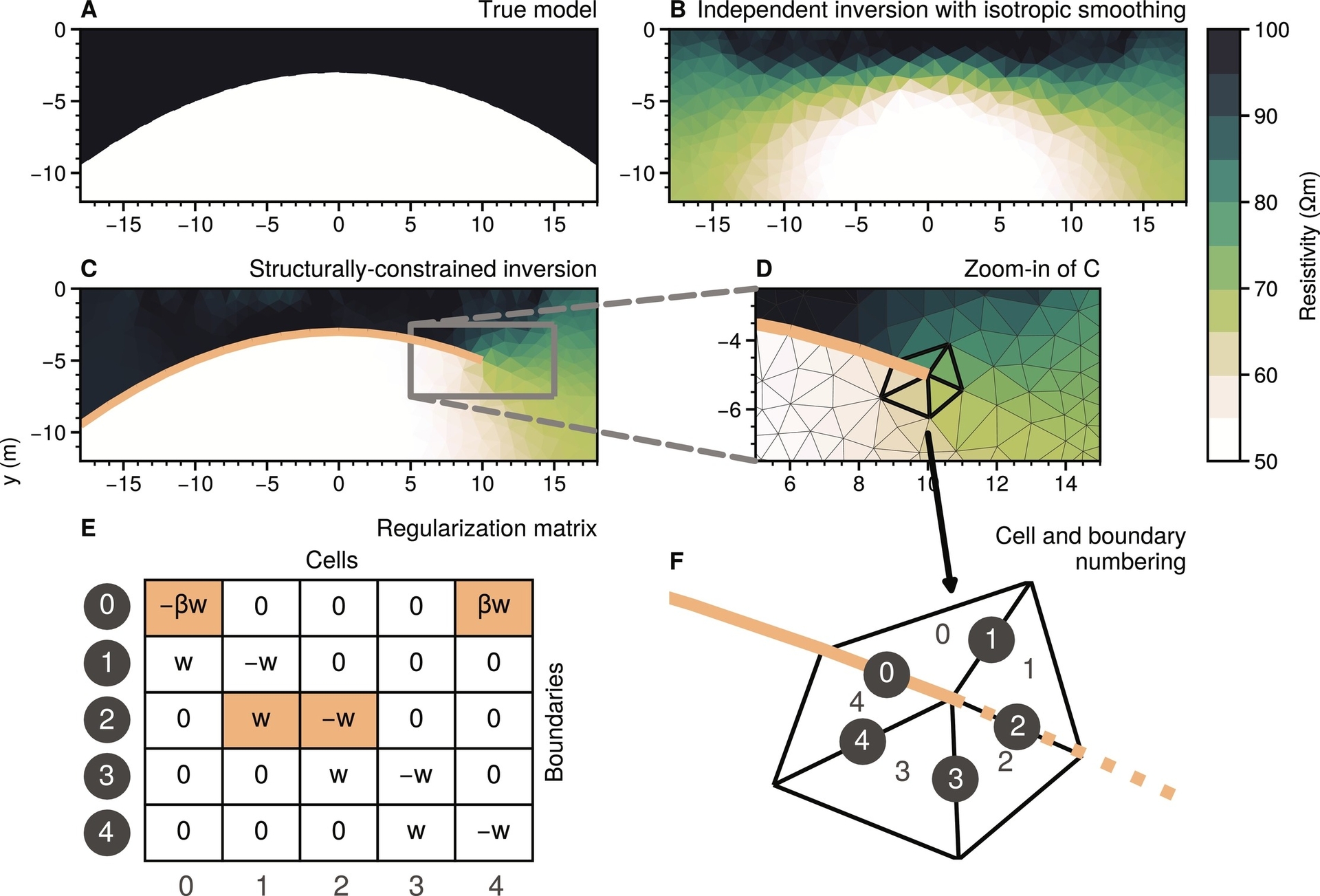
Florian Wagner and his colleague Dr. Sebastian Uhlemann from Lawrence Berkeley National Lab were invited to write a chapter for the newest release of the book series Advances in Geophysics on multimethod geophysical imaging. Geophysical imaging methods allow to image subsurface property distributions and monitor their spatio-temporal changes in a minimally invasive manner. While it is widely agreed upon that models integrating multiple independent data sources are more reliable, the number of approaches to do so is increasing rapidly and often overwhelming for researchers and, particularly, novices to the field. This contribution provides an overview, didactic introduction, as well as a discussion on advantages, disadvantages, and new research avenues in this exciting field.
Reference:
Wagner, F. M. & Uhlemann, S. (2021). An overview of multimethod imaging approaches in environmental geophysics. Advances in Geophysics, Vol. 62, Chap. 1, pp. 1–72, Elsevier, https://doi.org/10.1016/bs.agph.2021.06.001.
A preprint of the chapter is freely available here: https://doi.org/10.31223/X5HP67